Bringing practicality to way-finding & modernizing an old favorite
At Google, I helped lead Geo Visual Design through a period where Google Maps expanded beyond navigation into discovery, and Google Earth moved toward a browser-first experience. The work demanded high-density UI thinking, fast iteration, and tight collaboration across regions.
Role: Geo Visual Design Lead (US)
Scope: 2018 Maps redesign + Explore / For You + high-density geo UI foundations + 2017 Earth web experience + 2017 Local Guides refresh
Partners: Product, Engineering, Research + regional hubs (Seattle / Australia / Japan)
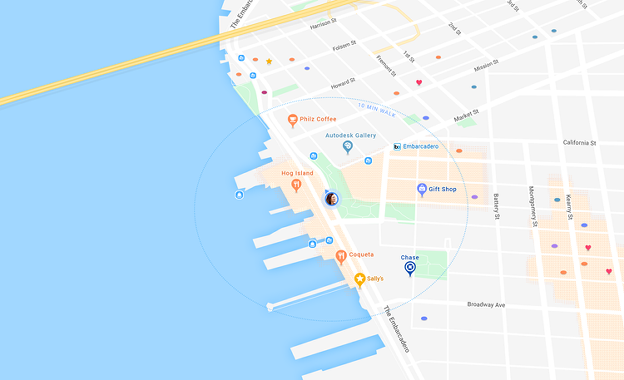
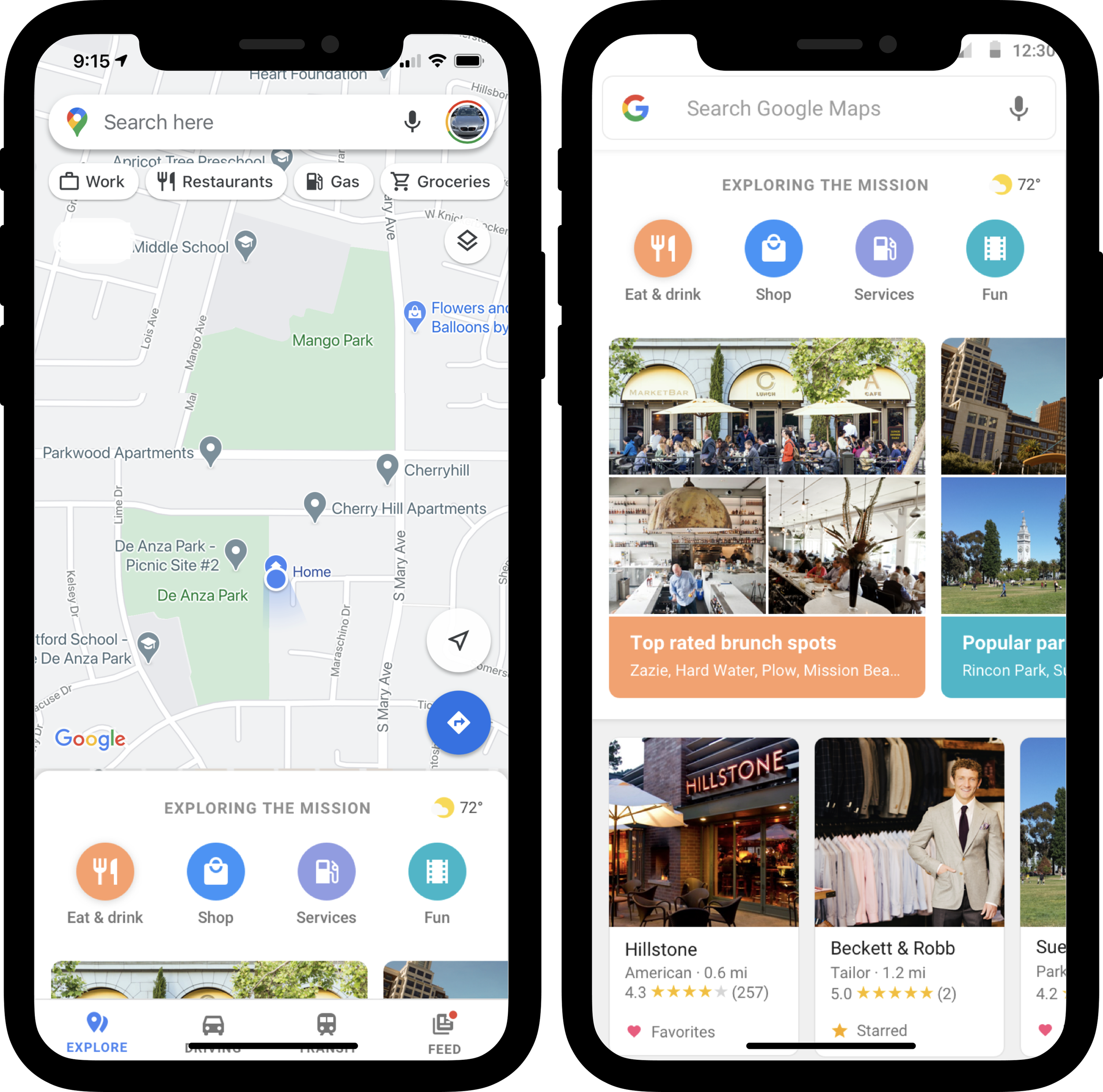
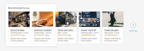
If a map tells you how to get there, could it help you decide what to do?
We studied how people choose places and saw a pattern emerge: users weren't just navigating—they were browsing. For ideas; things to do. And recommedations from people like them. The gap wasn’t accuracy. It was intent and trust. That insight shaped the 2018 Maps redesign, making discovery a first-class experience.
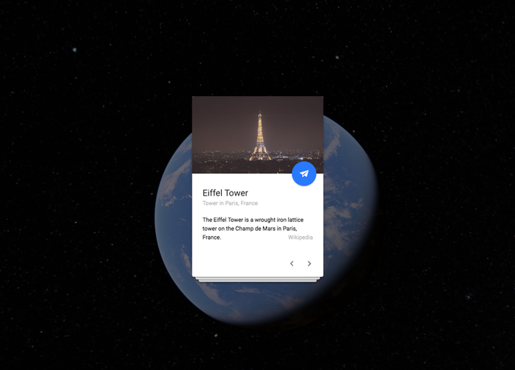
Earth 2.0
In parallel, we supported Google Earth’s transition from a desktop application into a browser-first experience designed for narrative discovery. The new Earth introduced Voyager as a cinematic storytelling engine and Knowledge Cards to surface context instantly—making the product more accessible without losing its sense of wonder.
This wasn’t a solo effort. I led the US-based visual design team while partnering closely with teams in Seattle, Australia, and Japan. My role was to set the bar, align priorities across time zones, and make sure insights weren’t treated like edge cases; they shaped the work.